The Archaeology of Hengistbury Head
WRITTEN BY Austin Kinsley ON 17/04/16. The Archaeology of Hengistbury Head POSTED IN General
Part 1
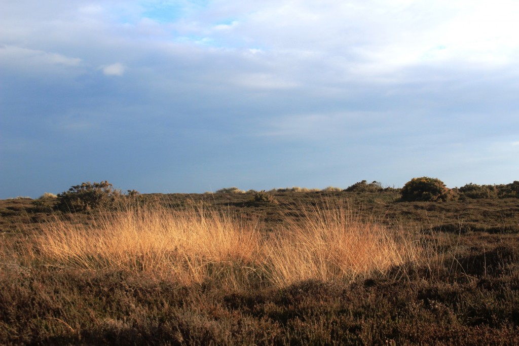
My first memory of Hengistbury Head is a childhood school visit and I recall huge banks of large pebbles on the beach, not unlike those on Chesil Beach further west along the south coast. I have visited the site probably thousands of times over the years for walks and occasional jogs along the seafront. I have also researched the archaeology of Hengistbury and its environs a little over the years, especially during my visits to the excellent Red House Museum who kindly allowed me access to their archives some years ago, before my local studies took a backseat to my Stonehenge-related activities and other projects from December 2013. Sometimes it is easy to overlook the history on one’s own doorstep, and to date I have written absolutely nothing on the subject of Hengistbury Head, which I am now planning to redress over a number of future blog posts as time permits.
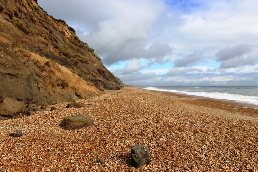
Hengistbury Head exists today due to the presence ironstone doggers rocks that have protected it from erosion by sea and wind. They were formed approximately 41 million years ago in the deep muddy water of a river delta that covered this area. It is made of a mineral called siderite or iron carbonate (FeCo3) mixed with sand and clay. Siderite acts like a cement binding the sand and clay particles together to form an extremely hard rock. The dogger contains up to 30% iron. Siderite readily turns to iron oxides, giving the dogger a rusty appearance.
Below: Ironstone doggers recently fallen from the cliffs onto the beach at Hengistbury Head:
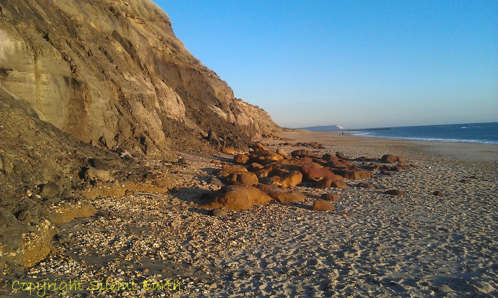
Ironstone doggers at Hengistbury Head
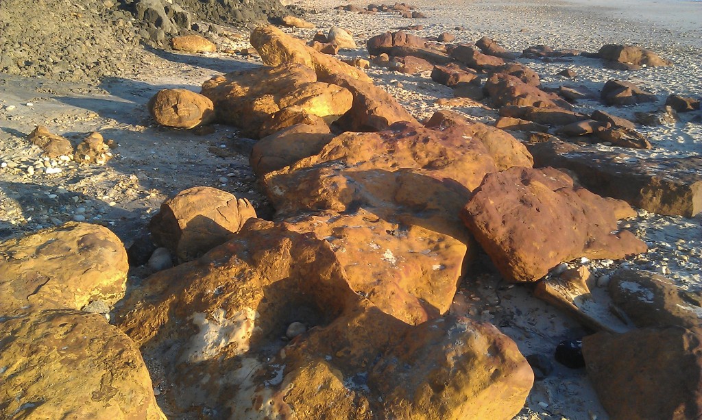
Ironstone doggers at Hengistbury Head
- The first recorded archaeological interest in Hengistbury Head is a letter published in Archaeologia in 1777 by Mr. Francis Grose, in which the earthworks are described and a plan included.
- The first major investigation was carried out by Mr. J.P. Bushe-Fox in 1911-1912 for the Society of Antiquities in London in advance of an extensive building scheme. Three barrows were excavated, the double dykes were surveyed and a substantial amount of occupation material was recovered from a large area of Long Field and a smaller amount in Barn Field. A full report of this work was published by the Society of Antiquaries in 1915 (research report 3).
- Mr. St. George Grey carried out further work in 1918-19 when he excavated those barrows not examined by Mr. Bushe-Fox and investigated the area covered by the Nursery Garden. No report of his work has been published, but it is referred to in Professor Barry Cunliffe’s later 1978 publication Hengistbury Head.
- In preparation for the setting up of a golf course, a substantial part of the Head (no exact area is known) was ploughed in 1913. Herbert Druitt, a local Antiquarian and collector, employed local men to collect thousands of flints from the ploughed area. The flints are mostly of Neolithic and Bronze Age date, but a group of late Upper Paleolithic, which resembles material from northwest Europe, has been identified.
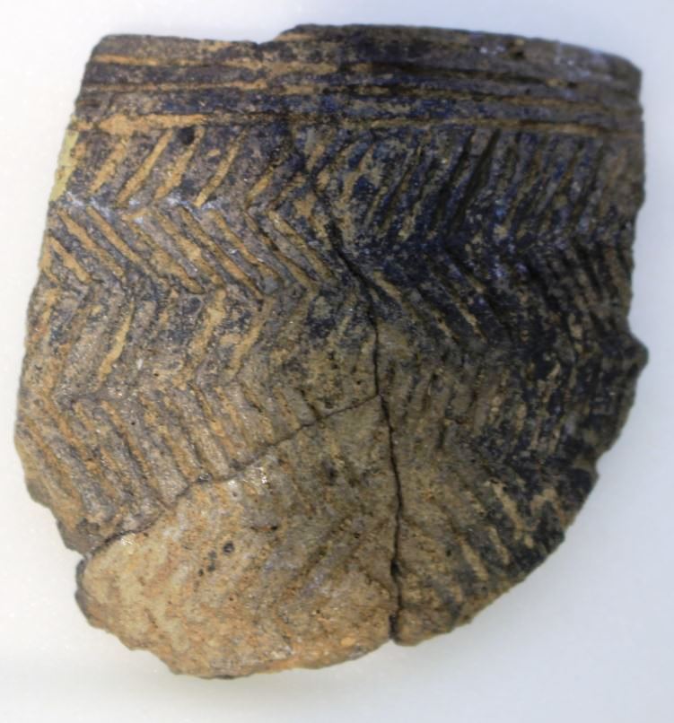
Hengistbury Head Grooved Ware Pottery
- Mrs. Angela Mace excavated in the area south of the cliff-path and north of the breakwater in 1957 (site 1 on the map below); this area had escaped the ploughing of 1913. The excavations produced important flint assemblages of late Upper Paleolithic material. The site is the only example of an open-air lowland site, in contrast to the cave occupation identified elsewhere. Published in Proceedings of the Prehistoric Society XXV (1959).
- Mr. Campbell excavated to the north of Angela Mace’s site in 1968 (site 2 on the map below). A similar range of material suggested that this site was contemporary with the Mace site, but provided evidence of two flint working areas.
- Mr. Peacock conducted an excavation near the foreshore on the north side of Long Field (site 3 on the map below). The excavations demonstrated the existence of a deep deposit of stratified archaeological levels of Iron Age date and the presence of waterlogged levels.
- Mr. Ridley conducted a survey of the whole of the head in 1969, recording the location of sites 4 to 19 on the map below and recovered over 5000 implements and flakes. Undisturbed sites were recorded in the vicinity of sites 1 and 2, as well as Upper Paleolithic and Mesolithic material at site 5 in the top left-hand corner of the map below.
- In 1975 Mr. Ridley observed the construction of the new coastguard’s hut. There were no undisturbed levels, but flint material from all periods were found.
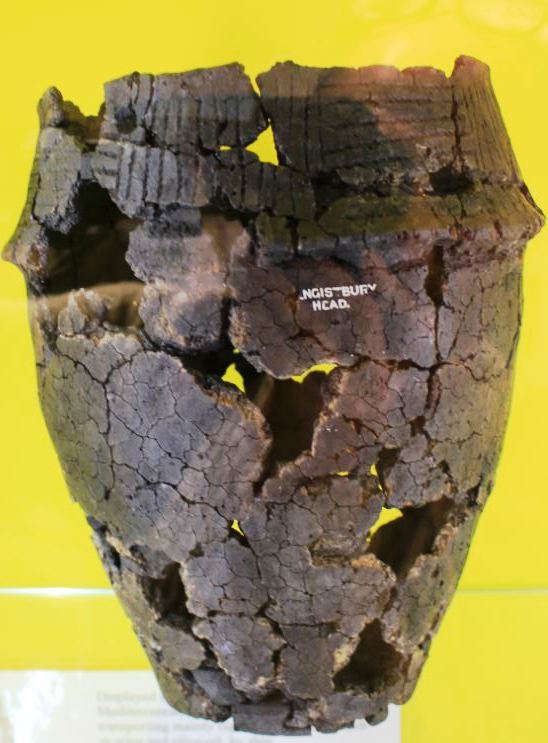
Hengistbury Head Bronze Age Cremation Urn
- An intensive field survey by Mr. Powell in 1977 produced 270 flint tools and established the importance of site 18 on the map below.
- Undated field work by Mr. Nobili-Vitelleschi, Mr. Cotton, Mr. Atkinson and Mr. King is reported by Mrs. Susann Palmer in her paper on the Mesolithic industries of Mother Siller’s Channel, published in Proceedings of the Hampshire Field Club XXVII (1970). Mesolithic material from Warren Hill, the southern foreshore, and elsewhere is studied in detail and the importance of the area in the Mesolithic period established.
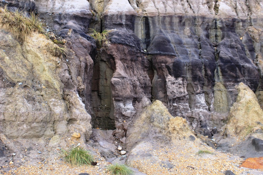
The cliffs at Hengistbury Head
- In the early 1980s, Professor Barry Cunliffe (Oxford University) and his team investigated the Early and Late Iron Age settlements including the Iron Age port, and Dr. Nick Barton (Oxford University) directed excavations on the Late Upper Palaeolithic, Old Stone Age site, at the eastern end of the headland.
- Many other casual finds have been made on the Head over a considerable period, including two fragments of inscribed slate, Roman brooches, silver and gold iron age coins.
Hengistbury Head looking south west
There are indications that some of the flints have Mousterian affinities and the Upper Paleolithic and Mesolithic periods are well represented. The Head was in use in the Neolithic and early Bronze Age. From the late Bronze Age to the Iron Age, there are significant indications of occupation and the area was in continuous use until around the time of the Roman invasion. The Iron Age occupation shows considerable overseas contact, that the occupants of the site were engaged in the metal industry and coin production, and that it had many of the features associated with an entrepot. The Head also has the greatest potential for the maximum period of change between the 1st century BC and 1st Century AD.
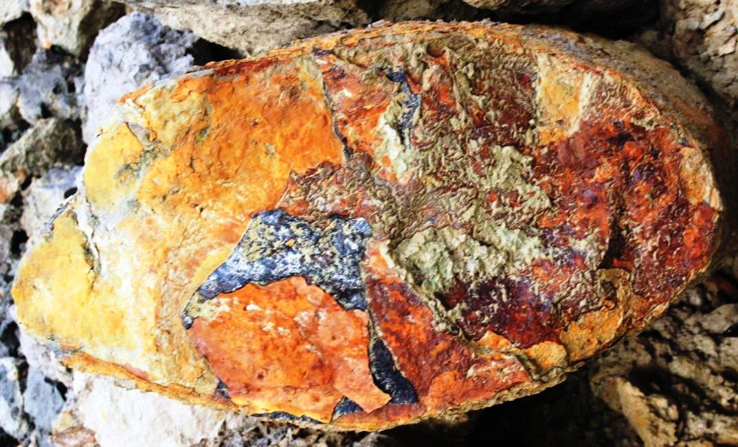
Ironstone Dogger Hengistbury Head cross section
Above: A cross-section of an ironstone dogger photographed on the beach at Hengistbury Head after heavy rain on 15 April 2016.
Below: Archaeological work and discoveries map to be viewed in conjunction with the bulleted points above.
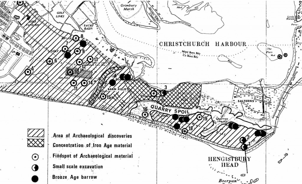
Hengistbury Head Excavation Map
Part 2 of the archaeology of Hengistbury Head to follow.
Thank you to Bournemouth Borough Council, The Red House Museum and Hengistbury Head Visitor Centre for the source information.