Mount Pleasant in Wessex
WRITTEN BY Austin Kinsley ON 13/09/18. Mount Pleasant in Wessex POSTED IN Dorset
During the recent dry spell in the summer of 2018 Silent Earth filmed the Mount Pleasant of Wessex prehistoric site and its environs from the air. As there is little to see from ground level and the field remains under plough to this day, this enigmatic site on which the known activities of man span the first half of the third millennium BC through to Saxon times is much overlooked. Here at the heart of Hardy’s Wessex on the southeastern outskirts of Dorchester (and 600 metres to the west, Thomas Hardy’s house at Max Gate) is a complex site that played a significant role in the evolution of the peoples of Wessex over millennia.
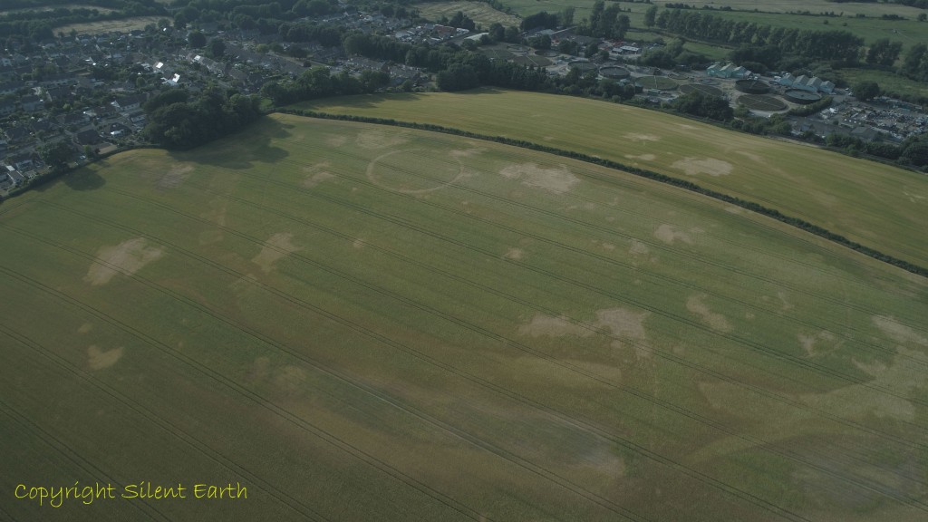
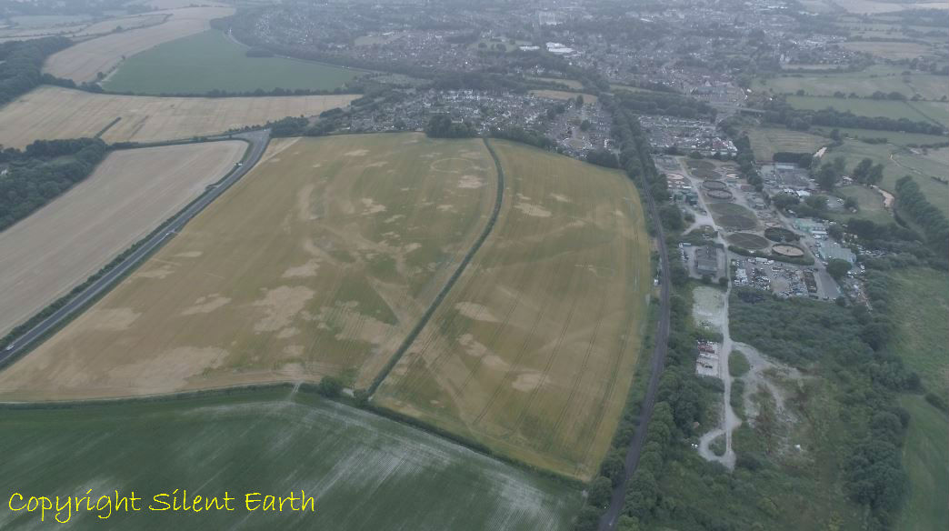
Below: The prehistoric complex lies in the upper centre of this photograph on a gentle upland spur of soft flintless upper chalk at the north of the Winterbourne valley on Mount Pleasant Hill, which runs approximately east-west. The river Frome is to the right here on the northern side of the site and, as can be seen from this photograph taken from the north east, the hill is in a prominent location on the southeastern outskirts of what is now Dorchester, the county town of Dorset with the Winterbourne Valley to its south and the Frome Valley to the north.
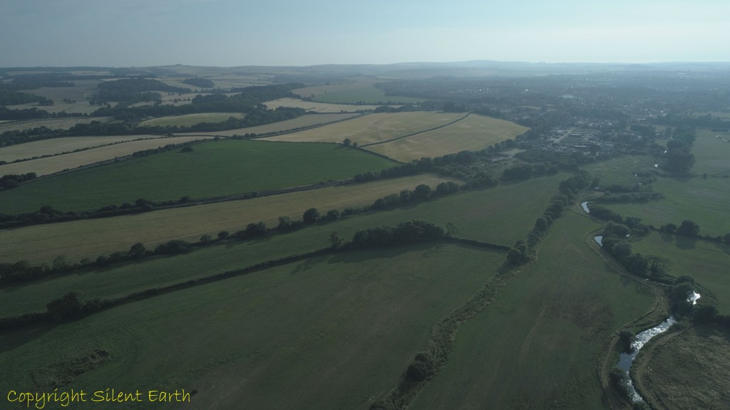
Mount Pleasant hill
The first antiquarian mention of the Mount Pleasant site was by Charles Warne in his 1872 publication Ancient Dorset as, ‘the vestiges of a large rectangular encampment, which I hold to have been Vespasian’s Camp, thrown up and occupied by him preparatory to his advance on the fortified heights of Dunium’, (Maiden Castle, which is 4.3km to the southwest.)
Other major contemporary or near contemporary sites in the vicinity are:
- Maumbury Rings, 2km due west.
- Maiden Castle, 4.3km to the southwest.
- Flagstones Henge, 607 metres to the west.
- Greyhound Yard, also referred to as Dorchester Tudor Arcade, 1.8km WNW.
- Allington Avenue Long Barrow, circa 600 metres due west.
- Conquer Barrow, which lies on the western edge of the henge enclosure at Mount Pleasant.
- Poundbury Hillfort, which began with a Neolithic enclosure and lies 2km WNW.
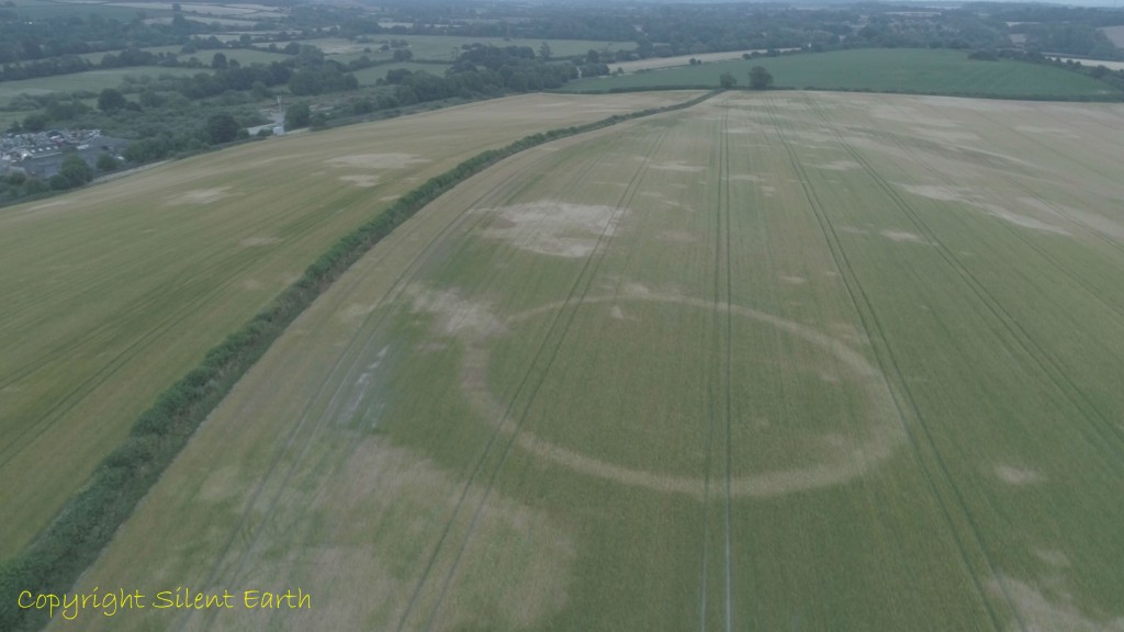
Below: This photograph taken from the southeast reveals a number of the prehistoric features on Mount Pleasant Hill. On first viewing this image, one’s eyes are drawn to the distinctly circular feature sited to the south of the highest part of the hill. Dr. G.J. Wainwright carried out excavations at the site in 1970-71, which are comprehensively summarised in the 1979 publication by The Society of Antiquaries of London, ‘Mount Pleasant, Dorset: Excavations 1970-71’. Dr. Wainwright named this area ‘Site IV’, excavating the whole feature, with the exception ‘of a slither of ditch in its east sector’ and summarises his discoveries in the above publication as follows:
- Phase I. A ditch 3-4 metres wide in diameter and with a maximum depth of 2 metres was excavated to surround a circular area 43 metres in diameter. The bank appears to have been external and a single causeway 7.5 metres wide was provided in the north. Within this ditch was a structure which comprised five rings of post-holes with a maximum diameter of 38 metres and with an innermost ring surrounding an area 12.5 metres in diameter. The layout of the structure is very regular and was designed around four corridors which divided the rings into quadrants … and the ceramic associations are principally with the Grooved Ware tradition.
- Phase II. When the ditch was approximately one-third full of silt and a weathered horizon had formed, the timber structure was replaced by a central setting of pits and sarsen monoliths representing a ‘cove’. Outlying pits and monoliths were recorded to the west, north and east. This rebuilding was associated in the ditch with sherds of beaker pottery’.
- Phase III. Iron Age settlement on the site is represented by a gully partially defining a hut 11 metres in diameter and associated pits. It seems likely that at this time the sarsen structure was demolished. A rectangular enclosure probably of Romano-British date, was built over the enclosure in its northwest part and ultimately a Saxon grave inserted into the ditch in its west sector.
Mount Pleasant prehistoric site.
Dr. Wainwright observed that the circular timber structure he discovered here is similar to those recorded at Durrington Walls, Woodhenge and the Sanctuary on Overton Hill near Avebury. In 1997, some 18 years after Dr Wainwright published the results of his excavations on Mount Pleasant Hill, English Heritage, in whose care Stanton Drew stone circle in Somerset is vested, carried out a detailed magnetometer survey of Stanton Drew. Historic England on their Pastscape record indicate:
- ‘This revealed nine concentric rings of anomalies within the Great Circle ranging from 23 to 95 metres in diameter. These are believed to be an elaborate pattern of buried pits or post holes. In the centre of these was a further cluster of anomalies, possibly pits, and around the whole of the circle was a 7 metre wide ditch with a gap of 50 metres to the north east. These rings may possibly have held timber uprights in similarity to other major sites such as Woodhenge and the Sanctuary’.
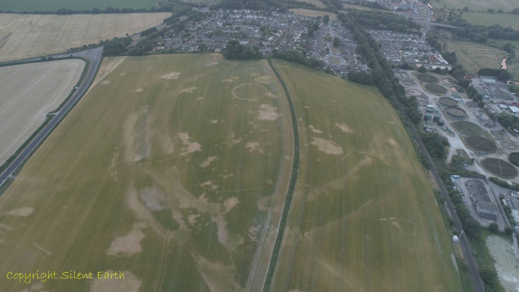
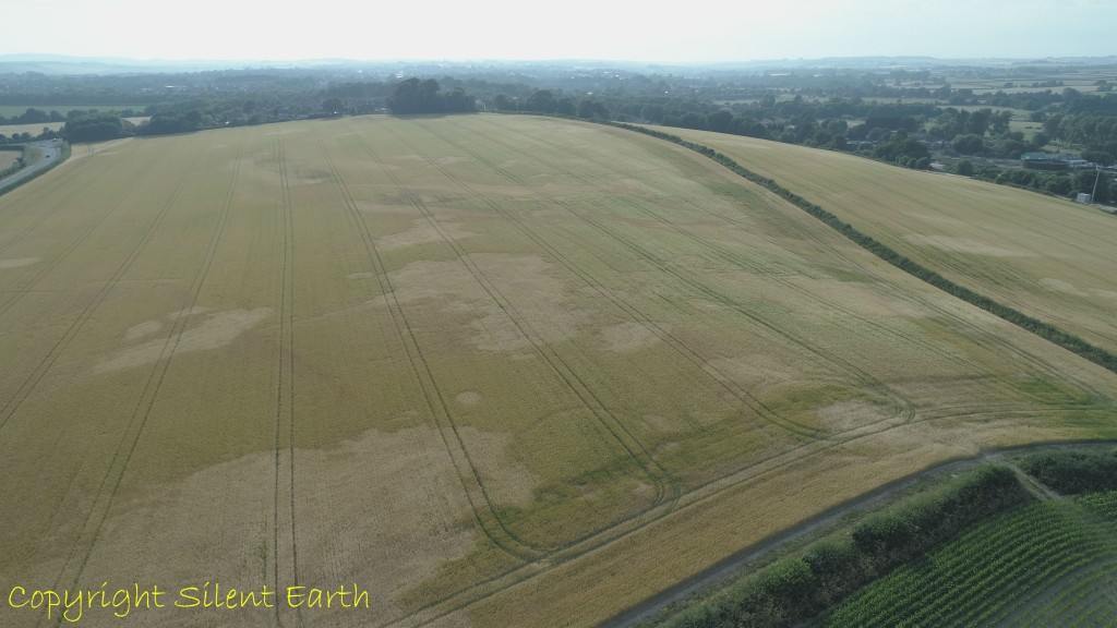
Below: Looking east across site IV and Mount Pleasant Hill. As can be seen in this photograph and observed by Martyn Barber, ‘the whole hilltop features an array of amorphous features’. In an English Heritage remote survey of Mount Pleasant published in 2014, (research report series no. 70-2014) from which the prior quote is taken, Martin Barber writes of these ‘amorphous features’ :
- ‘Many of these features may be of natural origin, produced by the pockets of clay or sand known to occur across the ridge from Mount Pleasant to Frome Hill and beyond; some may be solution holes, other tree throw holes. Some appear to be more regular in shape than others — oval or near circular — though none can be regarded as probably or possibly archaeological in origin solely on the basis of the cropmark evidence.
- It may be the presence of one or more of these potentially natural features — a solution hole perhaps — that contributed to the original significance of the hilltop for the enclosure’s builders’.
Looking east across site IV and the amorphous features, giving the hill a spotty appearance.
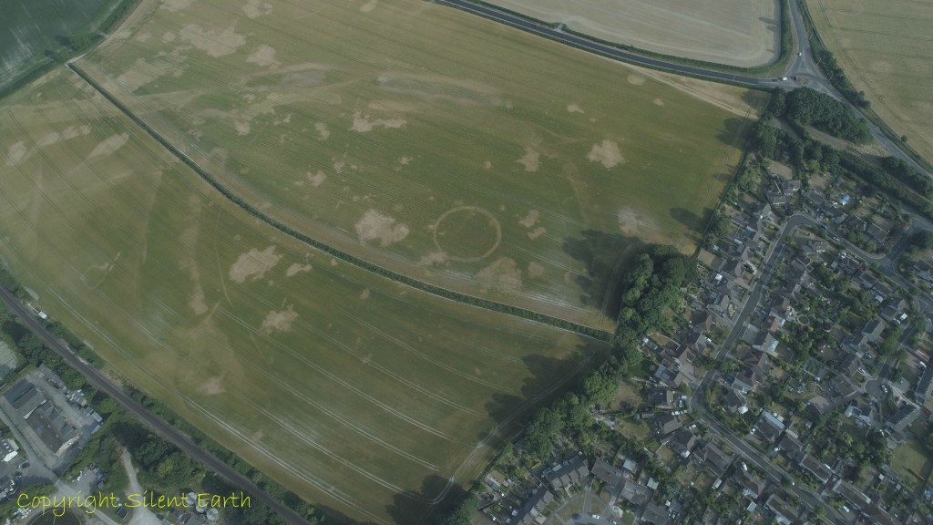
Below: Photographed from the east here, a thin continuous line of the palisade trench which surrounds a substantial part of the hilltop can be seen here on the northern, southern and eastern flanks of the hill. The 1970-71 excavations revealed this trench, which is oval or egg shaped, was of variable width, upwards of 3 metres deep and supported timber uprights of oak between 30-50 centimetres in diameter set close together. The enclosure formed by the palisade occupied the highest point of the spur between the 69 and 72 metre contours. Dr. Wainwright concluded that the palisade ‘follows a line best suited for defensive purposes in that it takes advantage of the natural contours’.
The railway line and sewerage works at the foot of the northern side of Mount Pleasant Hill, between the hill and the nearby River Frome, can be seen here along with houses on the outskirts of Dorchester immediately to the west of the hill.
A thin continuous line of the palisade trench is clearly visible here.
Below: This photograph, taken from the northwest, reveals the earthwork enclosure of a henge type, best visible here to the central upper left where a southeastern entrance to the henge enclosure is also clearly visible. Interestingly, too, to the upper left of this photograph is a wide parallel linear feature advancing on the henge enclosure from the northeast. This brings speculative thoughts to mind, such as that it may at one time have represented perhaps a dedicated approach to the hill from the River Frome, much like the Avenue at Stonehenge is a dedicated walkway linking Stonehenge to the nearby River Avon.
The henge earthwork enclosure is visible here.
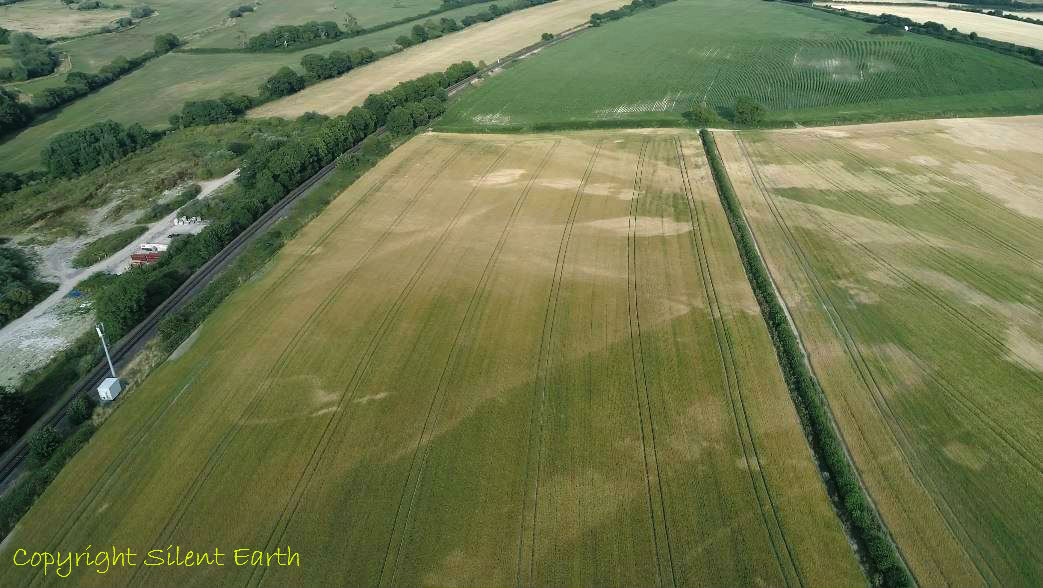
Below: On the northeastern flank of the hill, the possible ‘Avenue approach’ to the henge can be seen as far as the next field to the east.
The ‘Avenue approach’ to the henge.
Below: This photograph is taken from the northeast of Mount Pleasant with the River Frome on the right here to the north. The possible ‘Avenue’ walkway from the henge to the river can be seen to the far central left and, interestingly, looking to the lower centre of the photograph, running across a section of the field are two parallel lines heading towards the river. If these are separate elements of the Mount Pleasant Avenue, the question that begs itself is: How do the two elements of the walkway unite? As Carl Sagan once said, ‘Imagination will often carry us to worlds that never were. But without it we go nowhere.

Mount Pleasant Avenue
Below: Two ring ditches are visible here in the central foreground lower on the hill to the east, annotated E and F in the English Heritage remote survey of Mount Pleasant carried out by Martyn Barber and published in 2014, (research report series no. 70-2014). The feature on the right (F) is partially obscured by recent farming activity. Lyn Pease suggests this could possibly be a double ring ditch.
Ring Ditches E and F
Below: Ring ditches E and F from above.

Ring ditches E and F
Below: A little further to the east, lower on Mount Pleasant Hill, ring ditches A and B are visible here. C and D were not readily apparent during the visits.
Ring ditches A and B
Below: The old road to the central left is visible here. This passes Thomas Hardy’s nearby house at Max Gate, and perhaps, in far earlier times, represented a trackway from here at the southwestern foot of Mount Pleasant Hill to Flagstones Henge, which in Neolithic times partially stood on the grounds of Max Gate. If you look closely at the photograph, running parallel to the right-hand side of the old road, is another linear feature running much of its length. I would hazard a guess that the almost circular feature to the lower central left is one of the natural amorphous markings resulting from the geology of the hill, and was certainly not referred to by Martyn Barber as a principal feature in his 2014 report.

The old road.
Below: A somewhat rectangular feature on the lower northern slope of the hill facing the River Frome to the north. The henge and palisade enclosure can be seen to the upper right here. Perhaps a mortuary enclosure/house, Medieval or later farm building, maybe a platform for a sky burial, but it seems too low on the hill for a watchtower … Who knows? Pete Glastonbury observed a few years ago that this feature is a similar size to the square feature found inside Avebury’s southern inner circle.

Rectangularish feature.
Below: The rectangular feature to the lower left here, photographed from the west.
The rectangular feature photographed from the west.
Below: On the southern side of the hill here, amongst the natural amorphous markings, are circular features exhibiting discontinuity, linear features hinting of a triangular shape and a semi circular feature.
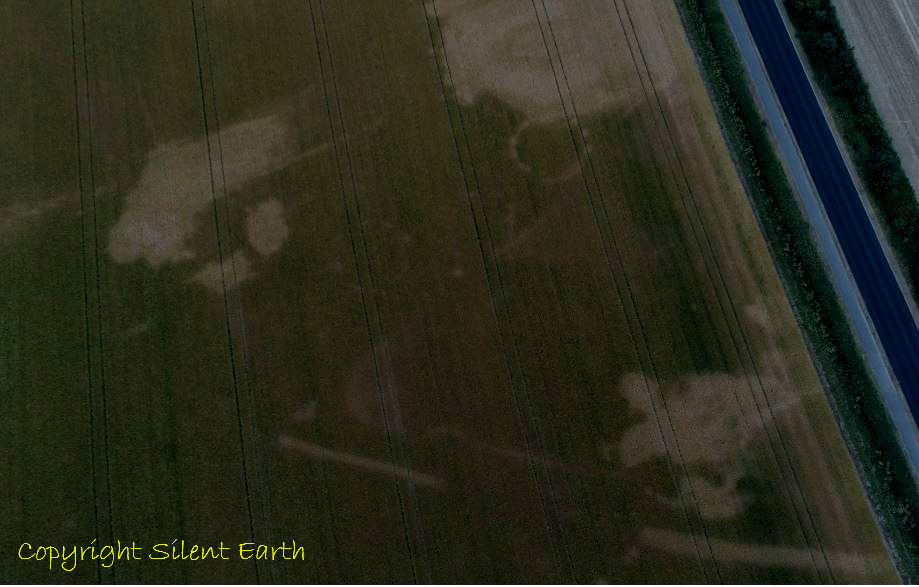
Natural amorphous markings and other features.
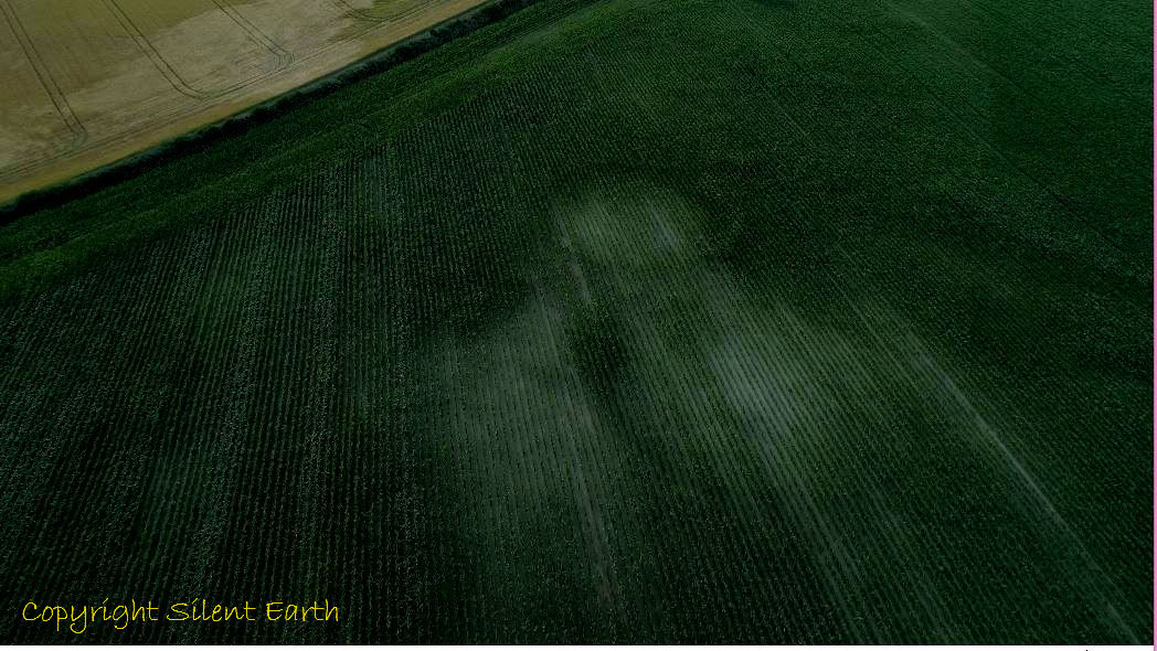
Below: A photograph in greater detail taken from the east of the circle of discontinuity to the upper right of the above photograph. I have enhanced this photograph, as it was taken with low light levels just after sunset. Andy Burns suggested these look like possible post holes with an entrance to the northwest. Interestingly, there is a triangular crop/parchmark clearly visible to the west of the circle.
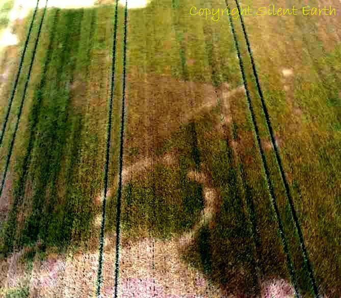
A circle of discontinuity with a triangular feature to its west.
Below: Site IV inside the henge and palisade enclosure. Within this circular feature was housed a circular five-ringed oaken timber structure and sarsen stone cove, amongst other features. Each year this field is ploughed and harvested; evidence of our yesterdays are scratched away just a little more.
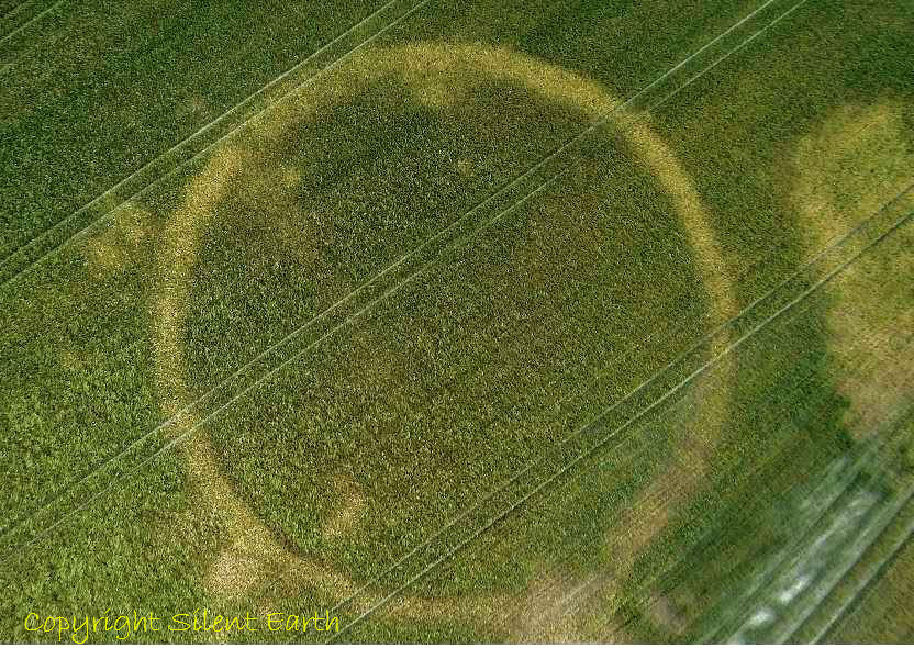
Site IV within Mount Pleasant henge and palisade enclosure.
The above photographs were all taken on 12th and 13 July 2018.
A few random facts from the excavations carried out by Dr. G.J. Wainwright during 1970 and 1971, summarised in the 1979 publication by The Society of Antiquaries of London ‘Mount Pleasant, Dorset: Excavations 1970-71.’ are as follows:
- 4130 finds of Neolithic and Bronze Age pottery were made of which 657 were in the style known as Grooved Ware and 1695 of the Beaker style.
- Nearly 3500 identifiable specimens of animal bone made up from seven different archaeological features, including wild species of auroch and boar together with a single specimen from a common crane.
- A total of 1621 sarsen stone fragments were found in the ditch of Site IV weighing 353 pounds 2 ounces. A further 581 fragments were found across the other features of the site, weighing 108 pounds four ounces.
- 9796 flint artifacts were found in the henge enclosure ditch.
- A number of worked chalk pieces were found, including at the west entrance of the henge enclosure ditch, object C2 ‘a carefully worked phallus 11cm long, the surface of which exhibits longitudinal striations. Along with the chalk ball C3 this artifact was recorded on the floor of the ditch to the south of the chalk causeway.’ 12 antler picks were also recorded in this area along with 110 fragments of animal bones, including pig, sheep, horse, dog and red deer.
- ‘By far the most numerous (chalk) artifacts associated with the palisade trench are the chalk balls, of which 30 examples were recorded – principally from the packing material which had been placed around the posts.’
- In the palisade trench 664 fragments of animal bone were recorded including song thrush, mistle thrush and pintail.
‘That man’s silence is wonderful to listen to.’
Thomas Hardy